
The Nautile is the inhabited deep-sea submarine operated by Ifremer. Able to reachdepths of 6000m, he made his first dive in 1984 and his first scientific mission the following year in the subduction zone off Japan during the KAIKO cruise, where he dived to 6000m. Since then, he has dived in different places, allowing scientists to observe and collect samples of rocks and deep fauna as well as fluids. The Nautile, along with the other deep-sea submarines, Alvin, Mir 1 & 2, Shinkai and Jiaolong, operated by research agencies from the United States, Russia, Japan and China, have been at the heart of major discoveries and pioneer researches on the deep sea. The ocean covers approximately three quarters of our planet. The vast majority of this surface has never been mapped and of these known parts, only a tiny portion has been observed directly by humans. You can visit the page dedicated to him on the website of the French Oceanographic Fleet here.
The Nautile is currently equipped with photo cameras and video camera systems capable of obtaining very high resolution images of the deep sea. It is also a machine capable of sampling rocks, fauna and fluids and deploying scientific equipment at the bottom of the sea. Unlike a ROV (Remote Operated Vehicles), which remain connected to the carrier ships, the Nautile is independent and can move freely in the ocean bottom, giving it great freedom of movement and flexibility, major assets in areas little or not explored, such as our work area.
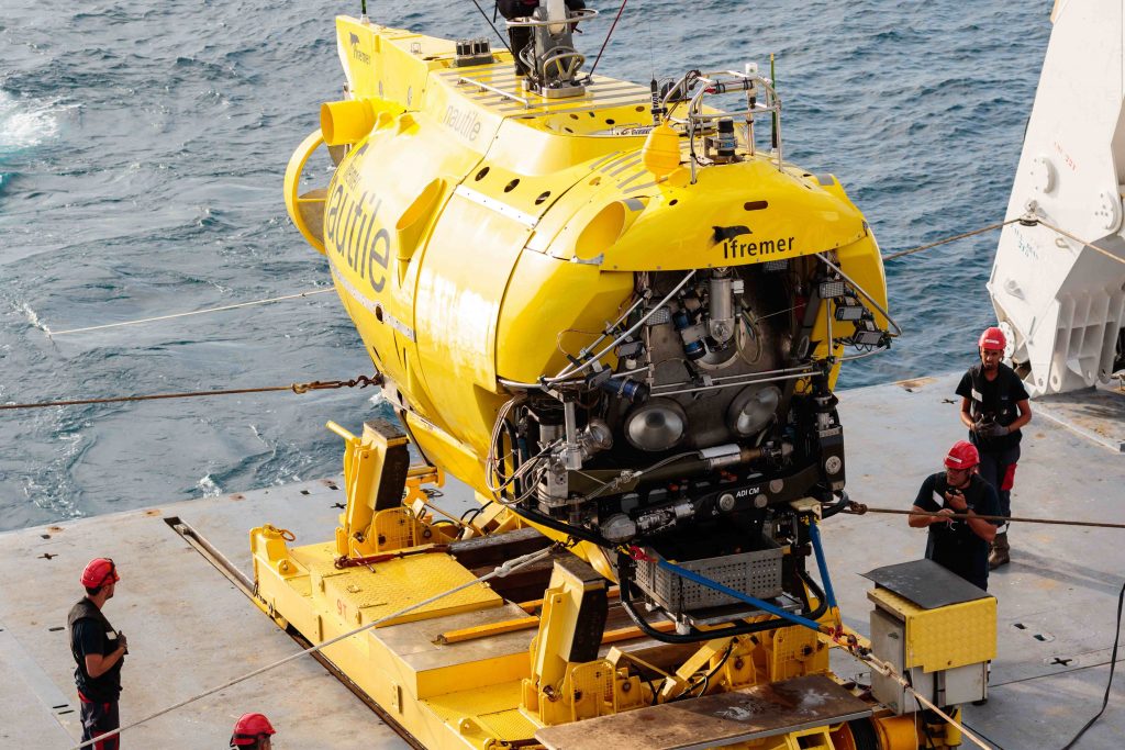
The Nautile on board the Pourquoi Pas? Photo C. Hamelin © Ifremer 
Tha Nautile Photo C. Hamelin © Ifremer 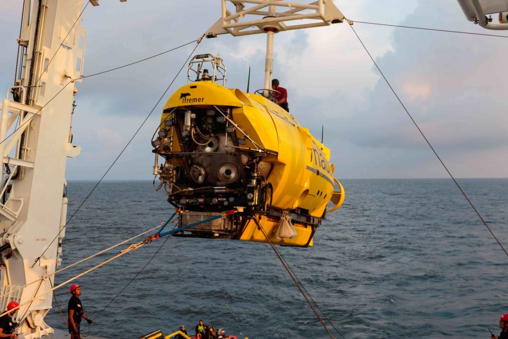
The Nautile Photo C. Hamelin © Ifremer
In the SMARTIES work area, the 23 planned dives are designed to study the mapped and sampled structures in previous cruises and confirm their nature: large detachments bringing deep rocks, especially the mantle, to the surface. Most dive sites are on topographic highs that we think correspond to these detachment surfaces, some old and, hopefully, some active. One site, with four dives, aims to obtain a profile of the crust and upper part of the mantle on the wall of the transform fault of Romanche. This section will be made along the seismic line realized by the ILAB project, intended to image the lithosphere-asthenosphere boundary and will be able to provide the true geologic section corresponding to the seismic section, improving the models. In the coming days, we will publish regular notes with the progress of the dives.
By M. Maia